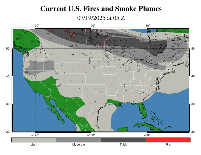
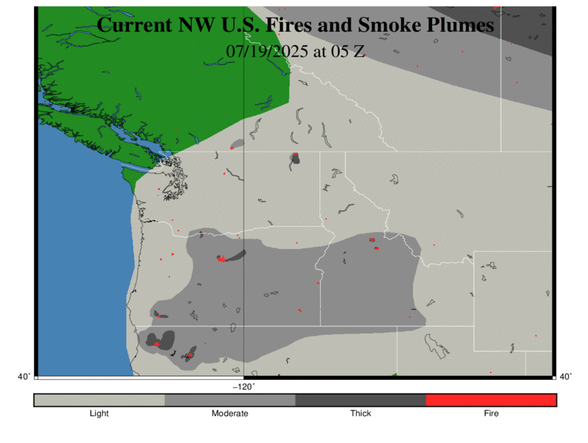
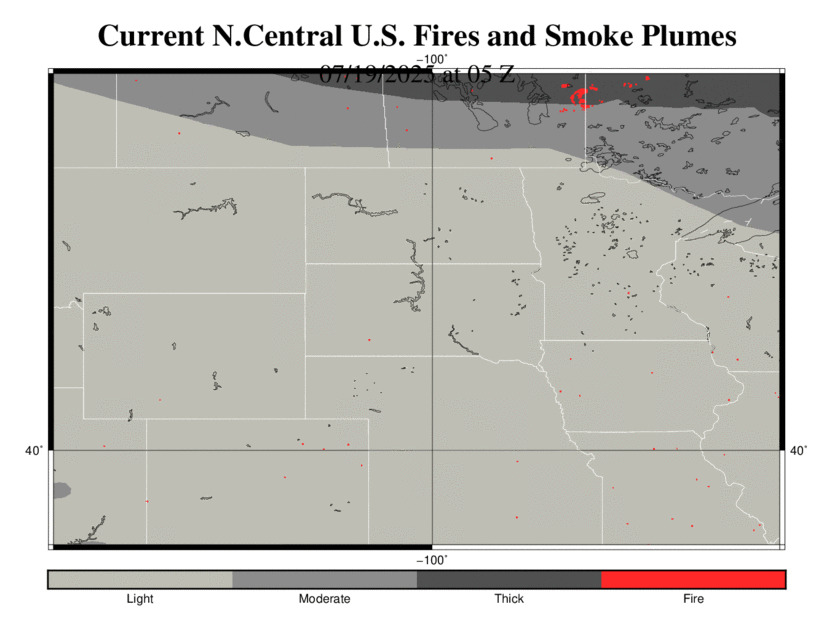
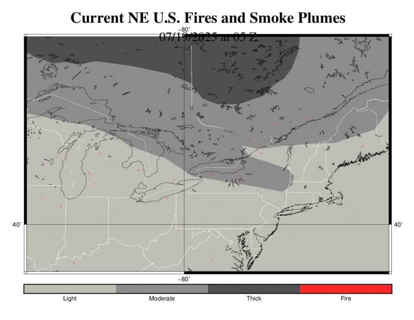
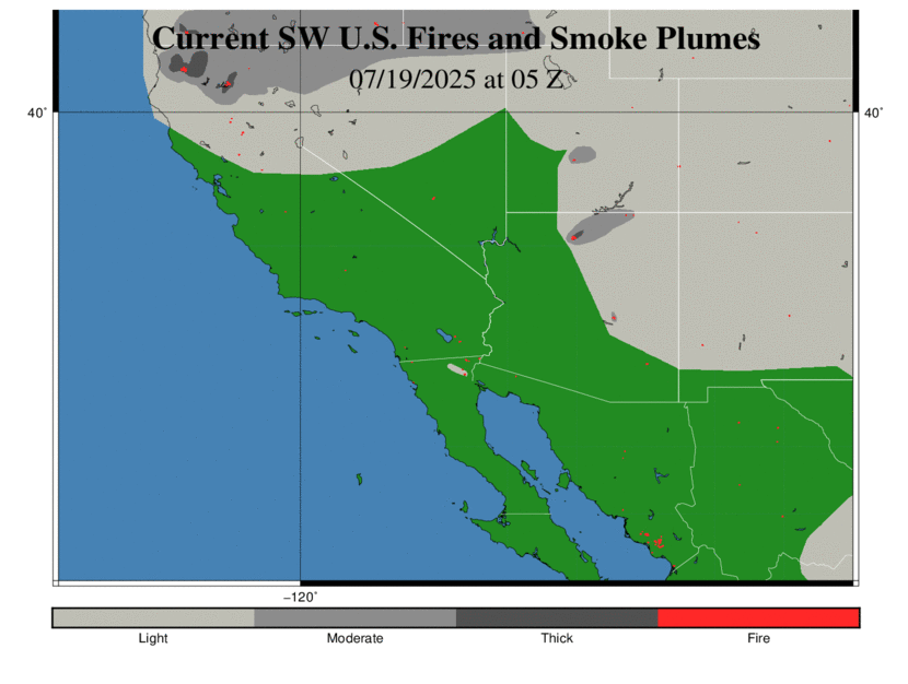
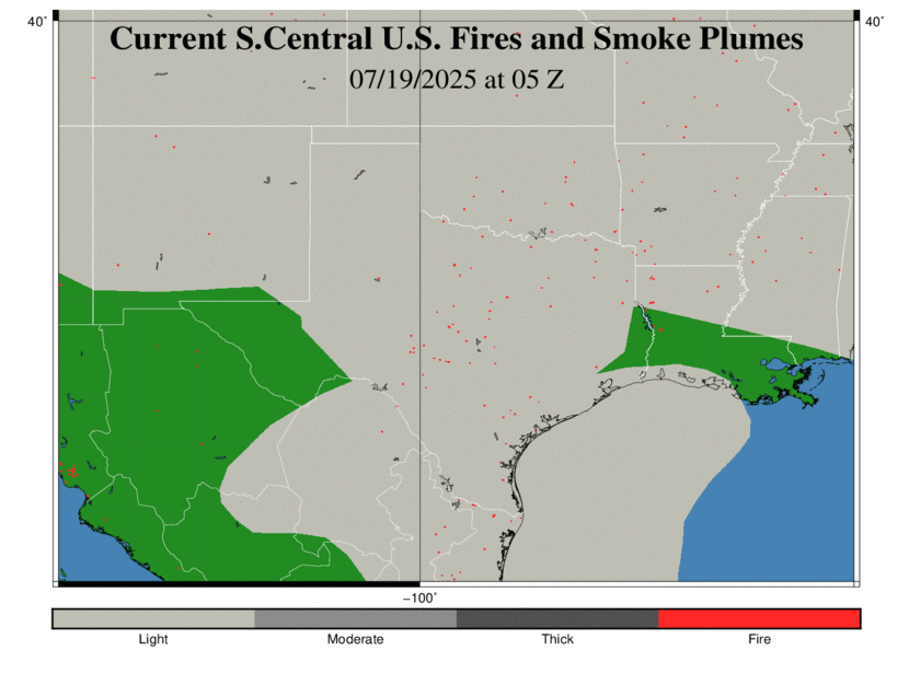
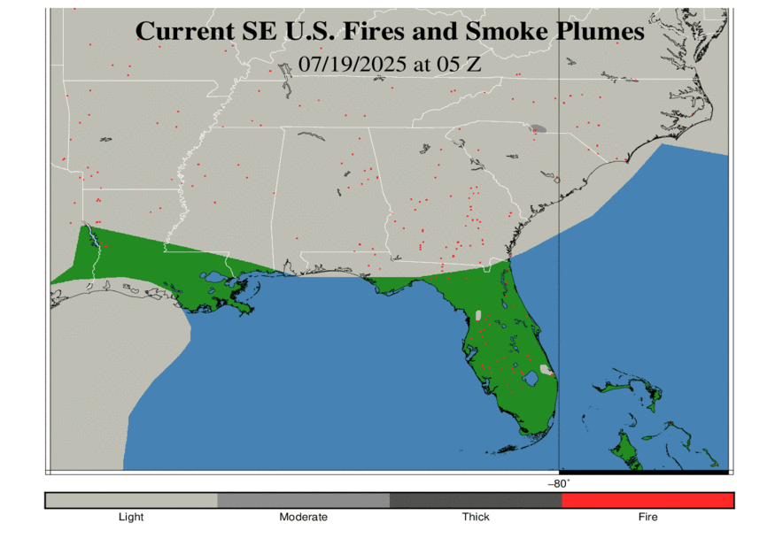
Fire and Smoke
Broadcasters have expressed a need to show where fires and smoke plumes are endangering the lives of their viewers. Fires damage land and property and can threaten lives if people are unaware of a close threat. Smoke and ash particles from the fire cause threats to public health, and can decrease area visibility and can hamper motorists.
WorldWinds has generated a product that will locate individual fire points. While all fires obviously generate smoke, environmental and other factors will affect how thick the smoke becomes. This product will display where light (between 1.0 and 10.5 micrograms/ m3), thick (between 10.5 and 21.5 micrograms/ m3) and very thick (above 21.5 micrograms/m3) smoke plumes are occurring across the United States. They represent where smoke is visible from satellite loops as detected by analysts. The map will update throughout the day as new data and analysis become available for interpretation.