Blended Total Precipitable Water (bTPW) with Upper Air Wind Analytics Overlay

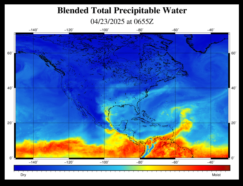
The blended Total Precipitable Water (bTPW) product shows “atmospheric rivers of moisture” of otherwise invisible water vapor feeding into storm systems. These plumes of moisture can be strikingly different than the water vapor imagery which shows only upper atmospheric moisture. The product contains a blend of data from several sources. Over the ocean, polar-orbiting satellites provide the data through microwave sensors. Over land, GPS stations measure precipitable water using signal delays to satellites, and GOES satellites measure precipitable water using retrievals in cloud free regions.
The bTPW is made available as a color contoured map each hour for animation. Additional calculations provide a 30-minute timestep to smooth the animation. The inclusion of a wind overlay for lower to upper air levels was suggested by TV broadcasters that were involved in beta testing for Phase I of the WorldWinds SBIR. Model output is provided by WorldWinds’ partner, Baron Services, at the mandatory wind levels for this purpose.